Located 800 m downstream from the Tapoul Canyon, a few kilometers from the village of Rousse, the Via Ferrata extends along the river Tarnon in an exceptional and relaxing setting.
Playful and accessible, it is ideal for a first approach to the activity and does not present any major difficulties.
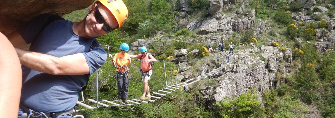
The via is classified PD or AD according to the chosen variant and consists of two Tyrolean, two footbridges and a monkey bridge.
Description Via Ferrata : Tapoul via ferrata
The meeting is at the village of Rousses, located between Florac and Meyrueis and 20 mins from both, one hour from Sainte-Enimie. You will find a small bar restaurant where you can quench your thirst after the activity.
You can also combine your activity with a visit to Mount Aiguoual, the highest point of southern Lozère, located about ten kilometers from the via ferrata.
Once you arrived at the via ferrata car park, you will be equipped with a climbing harness, a shock absorber specific to the via ferrata, a mountain helmet, and a pulley adapted to the cables. Remember to tie your hair and your glasses.
Then after a short downhill walk that joins the river in 5 minutes, your instructor will give you the instructions necessary to your progress on the cables in safety. The via ferrata then starts smoothly a few meters from the edge of the water.
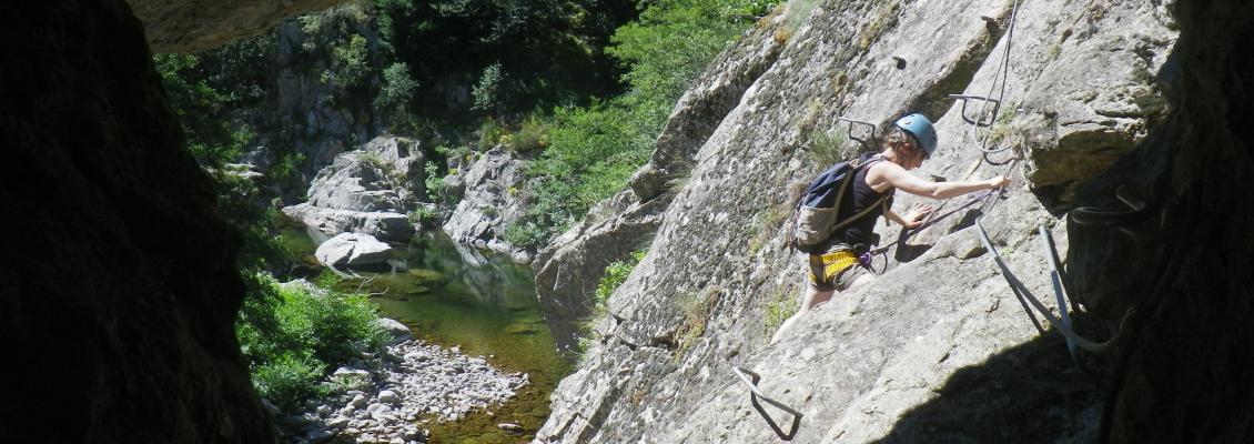
Two courses are offered: easy easy progression on a sloping plain, the other a little harder with a more physical vertical climb and a slight slope without much difficulty to pass.
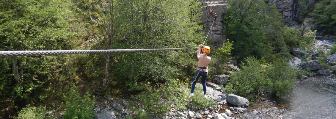
The two courses then meet to head out from a zip line of about thirty meters passing over the river.
The relatively athletic outing (the guide will be there to help you) leads to an elevated terrace from where you can opt for the easy route that crosses the river with another zip line or take a large footbridge followed by a passage to a relatively technical arm that leads to a small monkey bridge.
The two courses meet and the via runs along the river, the progression is easy with some passages without difficulty and again two courses are proposed: an easy part that passes over the cliff, and another more complex.
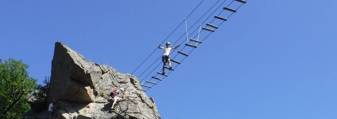
The two courses join again to a small bridge followed by a rather aerial technical passage and a vertical which lead to the start of the final bridge. A final step a little athletic takes you to a small terrace from where the return path will lead you in a few minutes to the road.
Roadmap : Tapoul via ferrata
How to get here:
- From Sainte-Enimie - 55 mns drive: Take direction Florac (30 mns), at the exit of the village of Florac take D907 direction Meyrueis.
After about 20 minutes, just after passing the village of "Les Vanels", turn left in a tunnel direction "Les rousses" (5kms). - From Meyrueis - 25 mins drive: Take direction Florac. After 20 minutes, before the village of "Les Vanels" turn right into a tunnel, direction "Les Rousses" (5 kms).
- From Florac - 20 mns drive: Take D907 direction Meyrueis. After 20 minutes, just after passing the village of "Les Vanels", turn left into a tunnel direction "les Rousses" (5kms).
The meeting place is located on the car park behind the bar "La Ruche" in the village of Rousses (48400). There are toilets and a water point. You can also have lunch at the restaurant "la Ruche" before the activity. The property is open daily during the summer season. Tel: 04 66 44 08 54
Warning: there is another village called the same name near Meyrueis. Be careful not to go wrong because in case of confusion you will not have time to join us on the site of the activity.
Necessary equipment : Pair of shoe type trainers
GPS coordinates: 44.206064, 3.589172
Payment: French cheque or cash, there is no cash dispenser at the venue.
Warning: Please arrive on time, the guide is unable to delay departure for participants who are late.
Localization Via Ferrata : Tapoul via ferrata
You can use the map below to calculate your route to your place of your activity. Remember to increase the estimated time by Google about 20%, corresponding to the time lost on our small roads.
Veuillez patienter pendant le chargement de la carte...